Icon: ![]()
Function: ConcaveHull
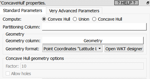
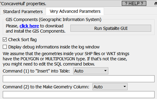
Property window:
|
|
Short description:
Create POLYGON’s from GEOMETRIES
Long Description:
To contruct some POLYGONs from POINTs inside Anatella, you can either use the ![]() tesselateGIS action or the
tesselateGIS action or the ![]() ConcaveHullGIS Action.
ConcaveHullGIS Action.
There are, basically, 2 use cases to use this Action:
•Use the “Union” mode to merge many small POLYGONs into bigger MULTIPOLYGONs: See the section 5.10.9.2. for an example where we merge tother 6048 geometries into only 95 geometries:

•Use the Convex/Concave mode to recreate a POLYGON from a set of points. If the input geometries are not points, Anatella will dissolve the input geometries into many points before recreating POLYGONs from the points.
|
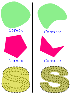
The opposite idea is called "concave". |
Given in input a set of points that “looks like” a “S” shape, the ![]() ConcaveHull GIS action produces as output this geometry (in yellow):
ConcaveHull GIS action produces as output this geometry (in yellow):

To create a ConcaveHull, the basic approach is that it first creates a convexhull of the geometry and then uses the ST_ClosestPoint function to cave in the hull to transform it into a concave hull.
The typical use case is to create a POLYGON from a set of coordinates that represents different given classes of Customers (one class per partition). The ![]() ConcaveHullGIS Action will then (re-)create a POLYGON that encompass all the Customers inside the same class.
ConcaveHullGIS Action will then (re-)create a POLYGON that encompass all the Customers inside the same class.
This Action assumes that the geometries are defined in a standard PLANAR coordinate system (i.e. not inside the SRID 4326), so for best results, you shouldn’t use it inside the SRID 4326 4326 (i.e. use the ![]() ReprojectGIS action to do all computations in a better SRID).
ReprojectGIS action to do all computations in a better SRID).


