Icon: ![]()
Function: Geocode
Property window:
Short description:
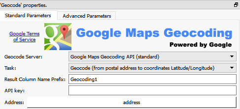
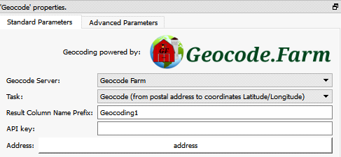
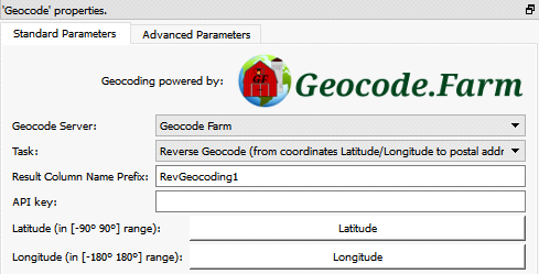
Geocode: Find the (Longitude, Latitude) of different Postal Addresses.
Inverse Geocode: Find the postal Addresses at different given (Longitude, Latitude).
Long Description:
The ![]() geocode Action that is detailed in this section uses two external service providers to compute the geocoding and the reverse-geocoding: Geocode.farm and Google. One last geocoding provider (i.e. BING MAPS) is accessible throught the
geocode Action that is detailed in this section uses two external service providers to compute the geocoding and the reverse-geocoding: Geocode.farm and Google. One last geocoding provider (i.e. BING MAPS) is accessible throught the ![]() bingMapGeocode Action detailed in the section 5.10.4. On June 2020, BING MAPS is the fastest and cheapest geocoding provider available. So, we strongly encourage you to use the
bingMapGeocode Action detailed in the section 5.10.4. On June 2020, BING MAPS is the fastest and cheapest geocoding provider available. So, we strongly encourage you to use the ![]() bingMapGeocode Action instead of the current Action detailed in this section.
bingMapGeocode Action instead of the current Action detailed in this section.
During geocoding, the ![]() geocode Action takes as input a table with a column containing a postal address (by default this column is named “address”).
geocode Action takes as input a table with a column containing a postal address (by default this column is named “address”).
The address formatting (in input) is very simple: For full addresses, just send the request in the same format you would use for a piece of mail (eg. 530 W Main St Anoka MN 55303 US). Just be sure to include the country at the end of the address to ensure accurate results. For zip codes, send the zip code along with the country in your request (eg. 55303 US). International addresses and characters are permitted by the API (Full unicode is supported).
The ![]() geocode Action ouputs a table containing all the fields from the input table plus these additional fields
geocode Action ouputs a table containing all the fields from the input table plus these additional fields
•<column_prefix>_Latitude
•<column_prefix>_Longitude
•<column_prefix>_Accuracy
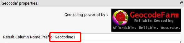
(the “<column_prefix>” is the parameter given here: ):
The “accuracy” field can have the following values:
VERY ACCURATE |
This is the highest level of accuracy and usually indicates a spot-on match. |
GOOD ACCURACY |
This is the second highest level of accuracy and usually indicates a range match, within a few hundred feet most. |
ACCURATE |
This is the third level of accuracy and usually indicates a geographical area match, such as the metro area, town, or city. |
UNKNOWN ACCURACY |
The accuracy of this result is unable to be determined and an exact match may or may not have been obtained. |
•<column_prefix>_Status:
This field can have the following values:
SUCCESS |
There are no account issues and query was successfully executed. Results were found and are displayed. |
FAILED, ACCESS_DENIED |
There are account issues and query was not successfully executed. Please see "access" field response for details. |
FAILED, NO_RESULTS |
There are no account issues and query was successfully executed. There were no results found for query, so no results are displayed. Check your query to ensure it is formatted properly or try reformatting the query. |
HTTP ERROR |
There is a network problem contacting the www.geocodefarm.com server. |
JSON ERROR |
The JSON response that we received from the www.geocodefarm.com server is invalid. |
•<column_prefix>_AddressReturned
The real address for which the (latitude, longitude) is returned.
•<column_prefix>_Access
This field can have the following values:
KEY_VALID, ACCESS_GRANTED |
There are no account issues and query can proceed. |
API_KEY_INVALID |
You entered your API Key incorrectly. Please double-check that your API Key entered matches that shown in the Dashboard Home screen. |
ACCOUNT_NOT_ACTIVE |
You need to check your email for the activation link for your account. Clicking on this link will activate your account and this message should then stop appearing. Ensure you check your "Spam" or "Junk" folders to ensure that your Spam Filter did not tag our email as Spam. |
BILL_PAST_DUE |
You are on a Paid Plan and your bill has not been paid. Please Login to your geocodeFarm.com Dashboard and pay the monthly fee to restore your API access. |
OVER_QUERY_LIMIT |
You have hit your daily limit for today. Upgrade your Plan if this occurs frequently or very often. This limit will reset at Midnight (12pm) PST and your account will be able to process until the limit is his again that day. |
•<column_prefix>_RemainingQueries
The quantity of remaining available queries fro the current day. Depending on your plan, you can have a maximum of 100.000 or 50.000 or 25.000 queries per day.
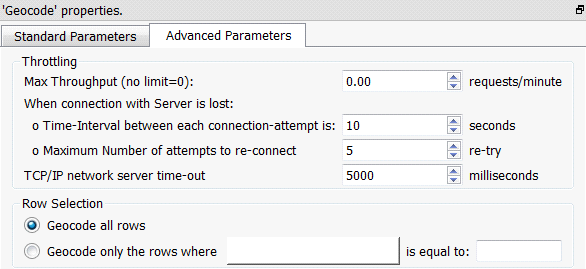
Some queries might fail for different reasons (maybe the internet connection is down?). When a query fails, Anatella makes several attempts to try to still get the answer (the number of attempts is the parameter named “Maximum Number of attempts to re-connect”). If Anatella still can’t get any valid answer after several attempts, all the remaining rows to process are set to an “Error status”. A row that is in “Error status” has:
•The fields “Longitude”, “Latitude”, “Accuracy”, “AddressReturned”, “Access”, “RemainingQueries” set to NULL.
•The field “Status” set to either FAILED, ACCESS_DENIED; FAILED, NO_RESULTS; HTTP ERROR or JSON ERROR.
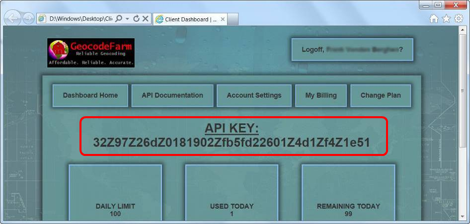
The parameter “API KEY” is the key that defines your geocodefarm account.
You can get it on the www.geocode.farm website:
To increase querying speed, you can place the ![]() geocode Action inside a “N-Way” Multithreaded section (see section 5.3.2.2. for more information about “N-Way” Multithreaded sections): For example:
geocode Action inside a “N-Way” Multithreaded section (see section 5.3.2.2. for more information about “N-Way” Multithreaded sections): For example:
Select a high “Number of threads” to get more speed:
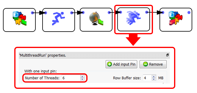
Warning: The Geocoding server might stop responding if you select a “too high” number of Threads.