Inside Anatella, the geometries are stored/represented using 5 different formats:
1.Point Coordinates "Latitude Longitude"
2.Rectangle "Latitude1 Longitude1 Latitude2 Longitude2"
3.Geometry data in WKT format
4.Geometry data in HEX format
5.Geometry data in BASE64 format
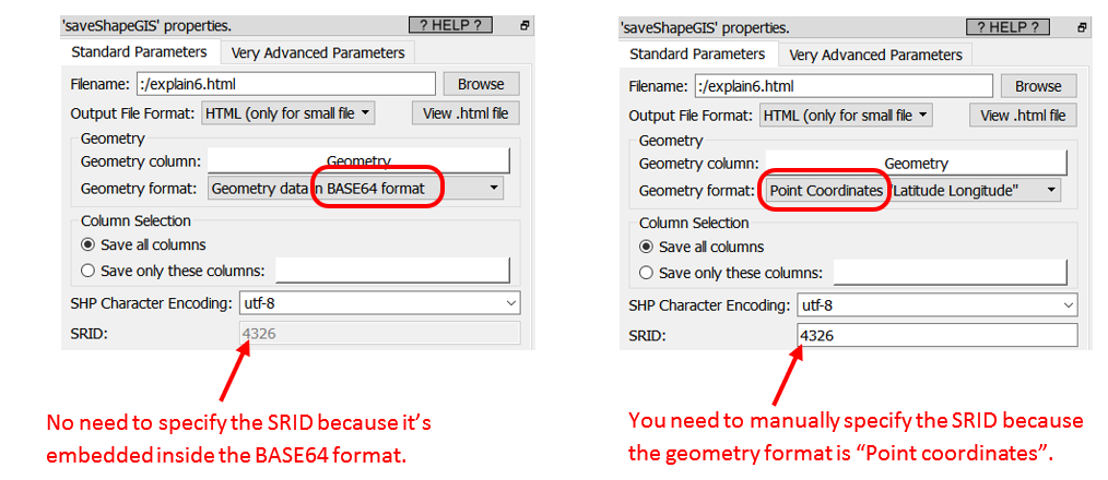
The data for the geometries stored inside the last 2 formats (the HEX and the BASE64 formats) include everything required to define the geometry: …And this includes the SRID! Using the GeometryInfo Action, you can see the SRID of the geometries (that are stored in HEX or BASE64 format).
In opposition, when using the first 3 formats (i.e. the POINT, the RECTANGLE and the WKT formats), some Actions will ask you to manually specify the SRID (because the SRID is not embedded into the data for these more primitive geometry formats). For example, when you use the ![]() saveShapeGIS action:
saveShapeGIS action: