Icon: 
Function: saveShapeGIS
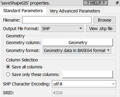
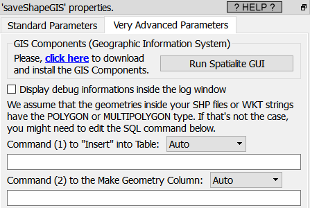
Property window:
Short description:
Create a .SHP file Or a .html file with the geometries
Long Description:
This action is used:
•To create .shp or .html files that contains geographical informations (geometries).
•To visualize your geometries using a nice graphical display.
All the parameters of this action are self-explanatory with the exception of the SRID parameter here:
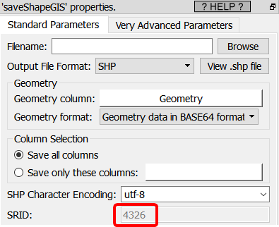
You’ll find more exaplantion about this parameter inside the section 5.10.10.2.
There are three different approaches to visualize geographical (GIS) informations:
•Look at small html file inside your browser.
•Look at a .shp file inside the small viewer embedded inside Anatella (from Avangardo.com)
•Design a beautiful&complex multi-layer representation using .shp files inside QGIS.
Here are the pros&cons of each approach:
Approach |
PRO |
CON |
HTML |
You can easily share the .html file with your collegue since its 100% self-contained.
Flexible format: e.g. you can mix POLYGON with MULTIPOLYGON inside the same file and it still works.
The map background is “Google Maps”: it allows to see your geometries “in context” inside a beautifully colored map (from Google).
Quick to generate and view. |
You can only look at geometries that are inside the 4326 SRID (i.e. with the coordinate system that is in “decimal degrees”).
You cannot choose the map background: it’s always “google maps”.
|
SHP |
To share the results, you only need to send 4 files: the SHP file, the SHX file, the DBF file and the PRJ file (you should put these 4 files inside a single zip and send the zip).
You can view geometries that have any SRID (i.e. with any coordinates system). Unlimited in size: Look at very complex geometries with thousands of points instantaneously.
Quick to generate and view.
|
The file format is not flexible: i.e. a single geometry TYPE is allowed and a single SRID is allowed (for each different .shp file).
Does not support the POINT and MULTIPOINT geometry type.
There is no map background to see your geometries “in context”.
|
SHP |
You can create a really beautiful & complex vizualisation with several transparent layers (usually, one layer = one .shp file).
Unlimited in size: Look at very complex geometries with thousands of points.
You can choose any map background: By defaut, it’s “open street map” but you can also use “google maps” (if you have a key) or use any other Tile provider. |
It’s more complex to share the results: a screenshot of QGIS is usually the easiest solution.
Slightly More Complex to use. |
Let’s give an example of vizualisation for each approach (see section 5.10.9.1. HTML visualization).
.